You are here
The history of the Amazonian climate lies on the seabed
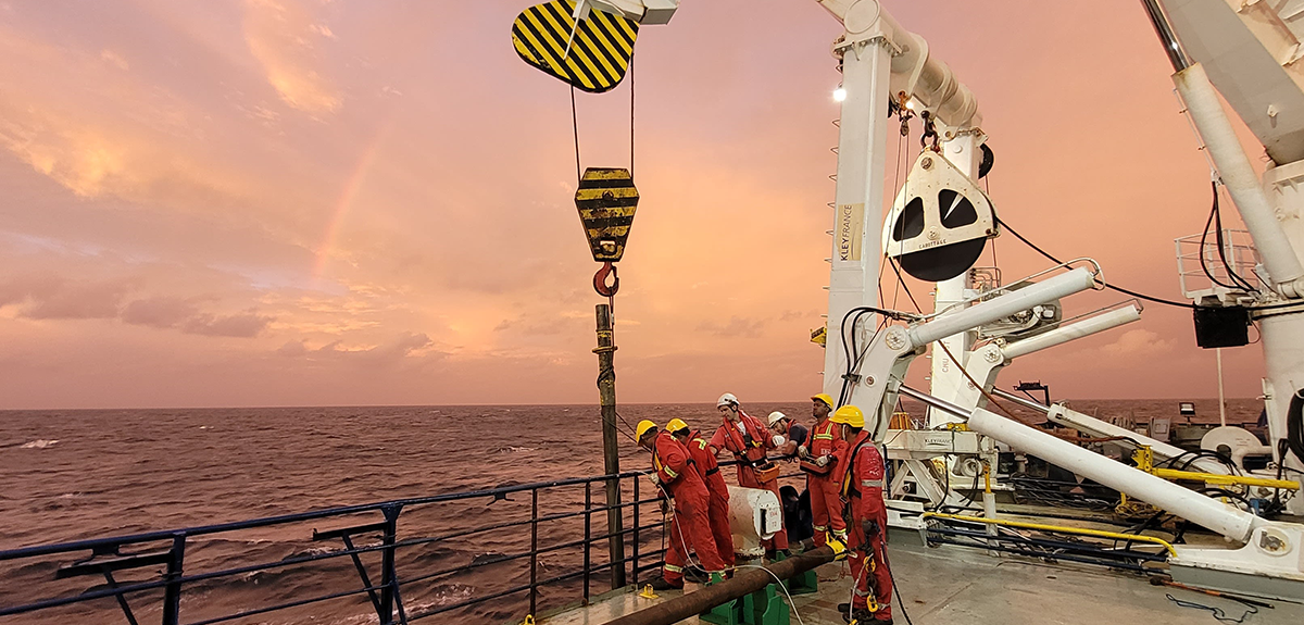
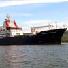
Bridgetown, Barbados, 1400 hours, 16 May 2023. The Marion Dufresne, a legendary vessel belonging to France's Oceanographic Fleet, is about to set sail with a crew of scientists, students, and technicians. For 49 days, with the Atlantic Ocean and the constant rumble of the ship's engines for sole companions, the members of the Amaryllis-Amagas mission1 will collect data and samples in a bid to elucidate the crucial role of the Amazon region in the Earth's climate system. To do this, they will sail back and forth across the continental margin off the coast of Amazonia and northeastern Brazil, an area where the submerged part of the continent slopes down to the abyssal plains.
The area is an iconic example of ongoing climate change. “Amazonia represents the lungs of our planet. It is home to the world's greatest biodiversity, including more than 10,000 different species of tree. It accounts for half the world's remaining primary forests, and makes up a quarter of the terrestrial carbon sink,” says Aline Govin, a CNRS researcher at the LSCE laboratory,2 who is spearheading the campaign together with Cristiano Chiessi, a professor at the University of São Paulo (Brazil).
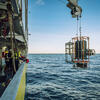
The researchers will be making use of a wide range of techniques, including sediment and water sampling, temperature readings, atmospheric dust collection and acoustic imaging, in order to reconstruct the climate history of the region, analyse the gases that form in areas where marine sediments accumulate, and observe the deposition of Saharan dust, which helps to fertilise the soils.
Millions of years of climate history locked up in sediments
At the root of this impressively diverse mission, which brings together a hundred participants from twenty labs and universities in France, Brazil, Germany and Sweden, was a need to collect core samples from the ocean floor. Over ten years ago, in 2012, the German University of Bremen had already carried out an oceanographic mission in the same region. “The campaign uncovered some fantastic marine sediment sites that enabled us to document the past climate with unprecedented temporal resolution,” Govin recalls. As a palaeoclimatologist, she uses such marine sediments to reconstruct the climates of the past.
The problem was that the cores collected during the German expedition were only around ten metres long at most, and therefore went back no further than 30,000 years, whereas Govin was interested in the last interglacial period, which took place about 125,000 years ago. During this latest interglacial, average global temperatures were slightly warmer and the sea level 5 to 9 metres higher than today.
“We have no record of what the Amazon region was like when the climate was a little warmer than it is today,” she points out. So there was an urgent need to collect new cores at greater depths. It was no coincidence that the Marion Dufresne was selected to carry out this mission, since it is equipped with Calypso, a giant corer that makes the French vessel one of the few in the world able to collect sedimentary cores up to 70 metres long in a single piece.
This makes it possible to investigate climate variation in the region dating back as far as several million years, which is one of the main goals of the Amaryllis component of the project, together with the study of the impact of Saharan dust on the fertilisation of Amazonian soils.
“We are asked to produce a great deal of future projections. And to obtain plausible scenarios, we need to be able to go back as far as possible into the past in order to find out what variations occurred and how the system under study reacted,” says Sébastien Migeon, who co-leads the Amagas component together with Daniel Praeg, a CNRS researcher. These two scientists from theGéoAzur laboratory3 are also extremely interested in sediment cores. “The Amazon carries more fresh water and sediment than any other river in the world. The sediment flows into the Atlantic and accumulates in what is known as the Amazon Cone,” Praeg explains. “The organic and inorganic particles it contains give us access, from the ocean margin, to the vegetation, precipitation, erosion and sources of sediment on the mainland, enabling us to document how these indicators varied in the past,” Govin adds.
Gas hydrates, a highly-sensitive carbon reserve
In addition, because of the pressure, gases, and especially gas hydrates, also form within these layers of sediment. “These gas hydrates are fascinating because they consist of frozen water that takes the form of cages containing molecules of gas, almost always methane. The amount of gas hydrate that may be buried on our planet is thought to be enormous, making it the biggest carbon reserve in the world. The problem is that it is highly sensitive to variations in pressure and temperature,” Praeg points out. In the future, with pressure on the sea floor increasing due to rising sea levels, combined with higher water temperatures, “a potentially huge amount of carbon could be released into the oceans”.
But that's not all. Such gas releases could make the sediments less cohesive, causing underwater landslides. “On land, the largest known landslides are around 2 km3 in volume and occur on fairly steep slopes. But here we're talking about phenomena exceeding 1,000 km3, on slopes of less than 2 degrees. We don't understand how such massive volumes can move such vast distances over such shallow slopes. It may be due to the destabilisation of the hydrates, which liquefies the sediment,” Migeon believes.
Giant underwater landslides of this kind could lead to the formation of tsunamis. “In a world where coastlines are ever more populated, this represents a real danger,” Migeon warns. “This process has been going on for millions of years,” Praeg adds. Finding records of the accumulation of such landslides in underwater sedimentary sequences helps to shed light on how they are linked to changes in regional and global climate conditions.
“The general public is more familiar with space than with what lies beneath the oceans on our own planet. In my opinion, underwater landscapes are much more varied than terrestrial ones. You can see some incredible things there,” Migeon says. A dedicated blog (in French) has been set up (link is external) to convey this sense of wonder and enable the public to share the daily activities of the scientific teams.
Forty-nine days at sea, a whole decade of research
This large-scale oceanographic campaign would not have been possible without the close cooperation of Brazilian researchers, as well as the agreement of the country's authorities. In fact, 14 of the 16 sampling stations are located in the jurisdictional waters of Brazil for the duration of the expedition. “Our entire scientific project had to be authorised by the Brazilian government. A Brazilian Navy observer is on board to monitor the officially approved programme,” Praeg says, highlighting the practical scientific collaboration between France and Brazil, in the context of closer ties between the CNRS and Brazilian research.4
The arrival of the Marion Dufresne at Recife (Brazil) on 3 July will herald the end of the Amaryllis-Amagas campaign. A quarter of the material collected will remain in Brazil, while the remaining data and samples will be shared out among the participants. “This is just the beginning of a long-term collaboration with Brazil. All the material will be studied jointly,” Govin points out. Forty-nine days at sea will yield enough data for a whole decade of research, providing a wealth of information to contribute to forthcoming IPCC reports, which are likely to focus on climate change at regional scales.
- 1. Amaryllis-Amagas is a merger between two complementary research projects. From 16 May to 11 June, the first part of the mission was dedicated to the Amagas component. From June 12 to July 3, the second half is devoted to the Amaryllis component.
- 2. CNRS / CEA / UVSQ.
- 3. CNRS / IRD / Observatoire de la Côte d 'Azur / Université Côte d’Azur.
- 4. An International Research Centre with the University of São Paulo, the fifth of its kind for the CNRS, is scheduled to open in early 2024.


