You are here
The strange cones known as molards
12.04.2024, by
As indicators of the degradation of permafrost – permanently frozen soil – in mountainous areas, molards are receiving special focus from researchers. In his laboratory in Caen (northwestern France), Calvin Beck is attempting to recreate these cones of debris from landslides.
On the same topic, see our video report Alaska: the ground is giving way (in French)

1
Slideshow mode
This laboratory molard is being studied by Calvin Beck, a doctoral student at the M2C continental and coastal morphodynamics laboratory in Caen (northwestern France). He is seeking to observe, understand, and model the formation of these mounds of stone and sediment, which in nature can range between a few dozen centimetres to several dozen meters in height. In his lab, the researcher controls all of the parameters relating to the evolution of these cones, with a view to creating a reliable 3D model.
Cyril Frésillon / M2C / CNRS Images

2
Slideshow mode
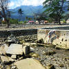
Only a few dozen sites presenting molards have been identified to date across the globe, in Argentina, Canada, Greenland, and here in Alaska. In mountainous regions, molards are an indicator of the degradation of permafrost, ground that is permanently frozen. Weakened by rising temperatures, blocks of sediments cemented in ice hurtle down slopes during landslides. As they heat up over the ensuing days, these frozen blocks adopt a characteristic conic profile.
Cyril Frésillon / LPG / CNRS Images

3
Slideshow mode
To obtain molards in the laboratory, Beck begins by making an artificial block of permafrost: he fills a wooden mould with a mixture of water and sediment brought back from Iceland during an earlier mission. Each cubic block weighs approximately 50 kilos and measures 30 centimetres on each side. During the experiments, the researcher changes the water and sediment composition of the permafrost blocks. This approach could eventually enable him to figure out the composition of the permafrost from which the molards found in the field originated.
Cyril Frésillon / M2C / CNRS Images

4
Slideshow mode
The next step is the laboratory’s cold room. Exposed to a temperature of -20 °C, the mixture of water and rock cools for a few days until it forms large cubes of ice and stone. Once entirely frozen, the block is removed from the mould and placed in an experiment room, where it slowly heats up to a temperature of approximately 17 °C.
Cyril Frésillon / M2C / CNRS Images

5
Slideshow mode
The frozen blocks are placed on a platform equipped with a water evacuation system. The wooden base displays various markers — akin to simplified QR codes — serving as so many “targets” for the camera network that observes the blocks of frozen sediment as they melt. These targets provide the scale for the final topographic model. The experiment can finally begin!
Cyril Frésillon / M2C / CNRS Images

6
Slideshow mode
For a few days, the ice melts and the molards gradually take their characteristic conic shape. Their evolution is monitored using photogrammetry: eight cameras take a photo every 30 minutes for two days. Beck can create a 3D model of the experiment by combining the photographs taken from different perspectives.
Cyril Frésillon / M2C / CNRS Images

7
Slideshow mode
Once the permafrost block has completely melted, Beck produces a topographic model for each stage of its degradation. The accelerated evolution of the 3D model allows for identifying the phases and key degradation processes based on the size and type of the sediments used.
Cyril Frésillon / M2C / CNRS Images

8
Slideshow mode
The formation of molards in nature results from the degradation of permafrost. Grasping how molards form in the laboratory could help scientists more precisely determine the nature of permafrost in mountains, where it is not continuously present, and to better understand its degradation under the effect of climate change. This is a crucial issue, considering that landslides in mountainous areas are likely to increase.
Cyril Frésillon / LPG / CNRS Images
Explore more
Earth
Article
01/08/2026
Article
11/09/2025
Article
10/22/2025
Article
07/16/2025
Article
07/07/2025
Geology
Article
12/06/2024
Article
07/26/2023
Article
10/24/2021
Opinion
12/14/2020
Article
01/16/2019
Molards
Video
04/09/2025


