You are here
Exploring the world’s largest ocean current
Catherine Jeandel, Hélène Planquette, you arranged to meet up on Réunion Island in early January. Why?
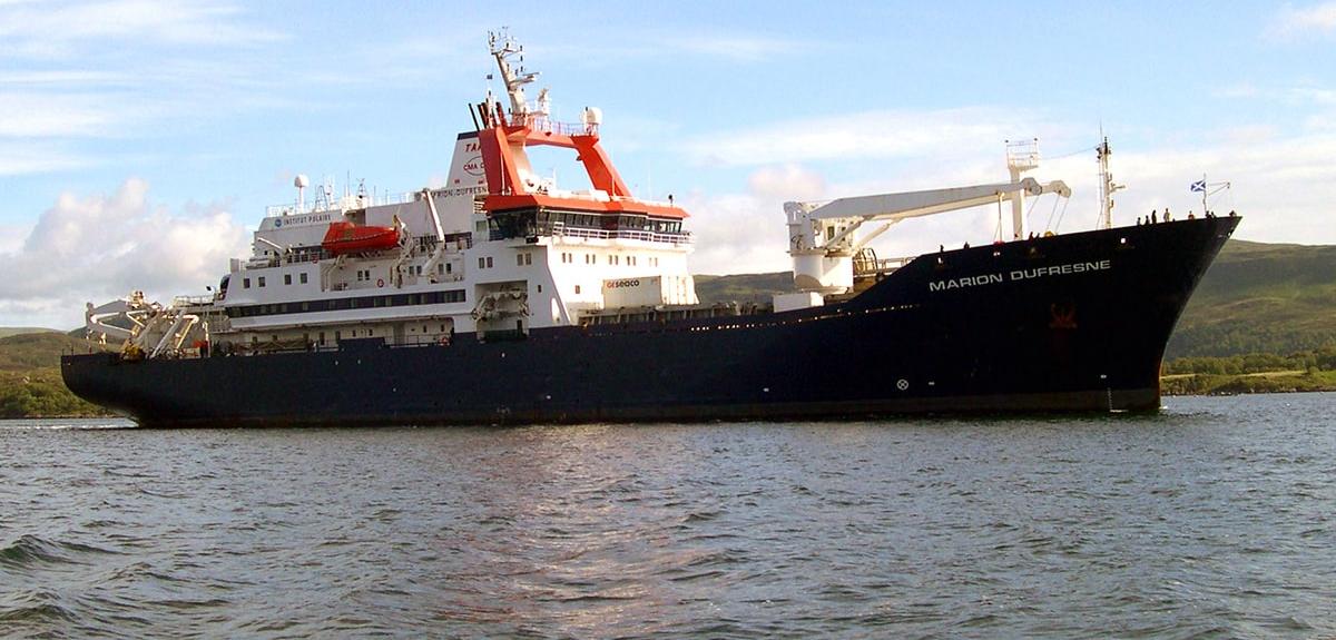
Hélène Planquette:1 On 13 January, we will be boarding the Marion Dufresne II, where we will jointly lead the SWINGS (South West INdian Geotraces Section) oceanographic cruise. The mission is planned to end on 8 March 2021, after eight weeks at sea in the southwestern Indian Ocean.
Catherine Jeandel:2 One of SWINGS’ main goals is to elucidate what is known as the oceanic carbon pump: in the natural carbon cycle, marine biology plays a key role by sequestering huge quantities of CO2 in the deep ocean.
You will do this by studying the transport of trace elements and isotopes within water masses, is that right?
C.J.: Exactly. The cruise is part of the extensive GEOTRACES international programme, whose objective is to describe and quantify the sources of chemical elements in the sea, their transformation once they are there, and finally how they are removed from it. To do this, we use the most ‘informative’ chemicals of the periodic table, which are actually very scarce in the ocean, as tracers.
H.P.: Throughout the mission, we will be collecting samples all the way from the surface down to the seafloor in order to determine the abundance of these substances, which are present in very low concentrations. They are called trace elements, hence the name of the GEOTRACES programme, which, like our discipline, is international and collaborative. Given the sheer vastness of the oceans, scientists from all over the world realised that it was essential to join forces.
H.P.: That’s right. Some of these elements are essential for the development of life. Called nutrient trace elements, they are the ocean’s vitamins. Iron, for example, is vital for surface photosynthesis. Others also play an important role, such as copper, zinc and cadmium.
C.J.: Then there are those that serve as tracers of processes. Some act as ‘dyes’, since they help to identify the sources of a material, while other naturally-occurring radioactive elements are used as ‘clocks’ to measure the rates of the processes being studied. For instance, thorium makes it possible to determine how fast material known as marine snow sinks through the water column, from the surface down to the sediments on the seafloor. As we obviously can’t sit on the seabed holding a stopwatch 3,000 m down the bottom, thorium is extremely useful to us!
Each of you has their own favourite area of study, right?
H.P.: Yes. For example, I focus on iron, a trace element essential for photosynthesis, the first link in the biological carbon pump. The Southern Ocean plays an important role in the sequestration of atmospheric CO2, and the agents of this process are complex, involving biological activity (surface photosynthesis, the food chain, carbon export to the deep ocean, sequestration in sediments) and ocean circulation (marine currents, transport of water masses). So it is important to find out where these nutrients come from and how they are transformed. To determine these sources and sinks, we make use of the distributions of other elements such as manganese and aluminium, as well as isotopes.
C.J.: Not all the chemical elements found in the ocean are produced there as the result of biological activity: some originate as dust on land, or as sediments deposited by rivers on continental margins, and so on. We also study these sources and transports. For instance, the isotopes of neodymium, a rare earth element on which I have done a great deal of work, can be used to establish the genesis of materials at a specific point, for example whether they have come from South Africa. We also measure barium, a tracer of bacterial activity at medium depths, and radium, which acts as a clock enabling us to determine how long ago the water left the coast. Each has a specific role to play in this very special tracking toolbox!
H.P.: That’s right! For traces of iron, it’s like looking for that contained in a paper clip, dissolved in 30 Olympic swimming pools! In the history of our discipline, we first had to agree on the protocols, to make sure we were measuring the same thing. This intercalibration, as it is called, took place at the end of the 2000s.
C.J.: This definitely changed the way we work. Measurements of trace elements are very recent. The first ones date back to the 1980s and 90s, once they became truly reliable, in other words devoid of contamination external to the samples.
What role does the SWINGS cruise play within GEOTRACES?
C.J.: The aim of marine geochemists (our discipline within oceanography) is to produce a world atlas of trace element data in open access. In addition, we still have a lot to learn about the mechanisms at work in the ocean, which in terms of ecosystems is nearly as varied as the continents, with their deserts, rain forests, grassland, etc.
So this is a huge challenge, and taking it up individually makes no sense. The GEOTRACES programme was set up in the 2000s by researchers themselves in order to identify the most suitable places to investigate, taking into account the oceanographic fleets and scientific interests of each nation. In marine research, collaboration is more important than competition. The SWINGS cruise will explore the south-west Indian Ocean and will be sailing in the world’s largest ocean current, the Antarctic Circumpolar Current.
H.P.: Access to this sector of the Southern Ocean is made easier for the French scientific community by the Marion Dufresne II, which regularly provides logistic support for the Crozet and Kerguelen Islands for example. The SWINGS mission is a crucial contribution to GEOTRACES since it is the only oceanographic campaign in the region. As well as the nutrient elements mentioned previously, we will also be studying the circulation and physical transport of water masses in this area of the Antarctic Ocean. Our research is just one small addition to the whole picture. But if we can shed light on such transport, as well as on the mechanisms of the biological carbon pump, which traps atmospheric CO2, dissolves it and deposits it on the seafloor, we will improve our understanding of the impact of the ocean on the climate.
What sampling and experiments will be carried out on board?
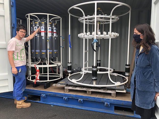
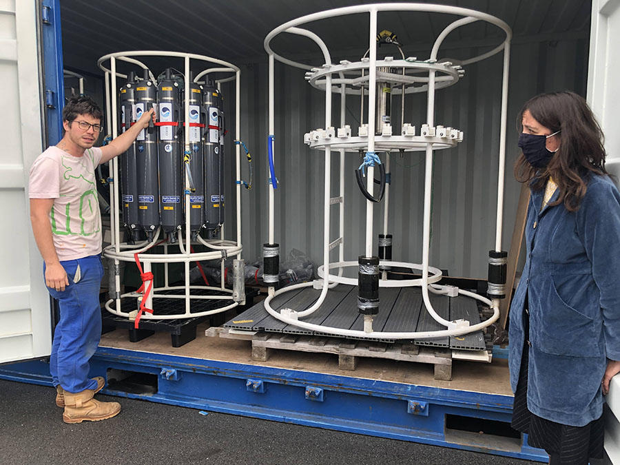
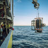
H.P.: We have several instruments at our disposal: two rosettes equipped with 24 twelve-litre bottles, one of which will sample trace metals that will be collected in a dedicated clean room, specially fitted out in a 20-foot container. A ‘tow fish’ will continuously extract water from behind the boat, which will then be pumped into the clean room. These extremely valuable facilities are run by the technical department of the CNRS’s National Institute for Earth Sciences and Astronomy (INSU) at Plouzané, (northwestern France). In addition, our colleagues from abroad will also be providing aerosol and rainwater samplers.
C.J.: We will also use some 15 pumps capable of filtering 1,000 litres of seawater over a period of around three hours, at depths targeted for their interest. And we will undertake sediment coring at specific points.
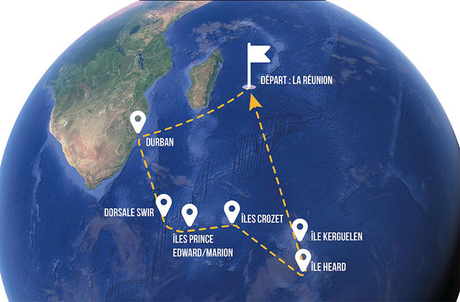
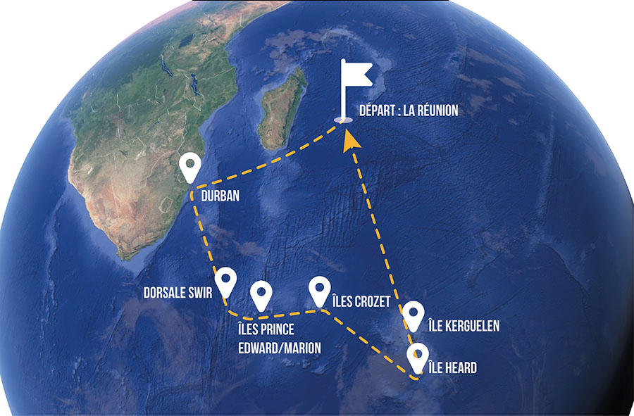
What route will the cruise take from Réunion?
C.J.: There can sometimes be significant input of material downstream from islands, due to their erosion. We shall be on the lookout for possible stimulation of plankton growth and richer biodiversity. We are also going to compare the northern regions, where the water is warmer, with the colder southern areas. Between South Africa and the first island we come to, Marion Island, we will spend three days investigating hydrothermal processes near a mid-ocean ridge, which is a kind of underwater mountain range. South of Kerguelen and Heard Island, we will cross a deep trench area into which a circumpolar current flows, horizontally in this case, carrying chemical elements from west to east.
H.P.: The cruise itinerary was designed to cross the areas Catherine mentioned. However, on board, a small forward-planning navigation team, to which we will belong, will fine-tune the route several days in advance. A member of the team has designed a software programme, a sort of routine that will enable us to adapt our course and measurements to any logistical and weather contingencies. This will help us to avoid taking samples haphazardly, since we will have access in real time to chlorophyll concentrations obtained by satellites, as well as to altimetry equipment that will provide us with the exact position of surface currents.
Are measurements taken 24 hours a day?
C.J.: Absolutely, and seven days a week! There are 105 people on board, including 48 researchers and scientists just for the SWINGS mission. In addition to studying the sources of trace elements, the transformations of their physical, chemical and biological state in the water column, and the ways in which they are removed from the ocean, we are planning to compare the concentrations of CO2 in surface waters and in the atmosphere. This is why France’s Indian Ocean observation service, OISO, which has been carrying out this annual monitoring for the past 30 years, will also take part.
H.P.: Besides, SWINGS includes a second temporal data monitoring programme, called THEMISTO. Its purpose is to investigate pelagic ecosystems using acoustics to establish the high-resolution 3D distribution of zooplankton and micronekton over a wide range of latitudes. The idea is to understand how these organisms are spread out in relation to ocean physics, biogeochemistry and climate, and also to top predators that gather in certain marine areas to feed.
C.J.: One more project, MAP-IO, will use the ship as a base from which to carry out physical measurements of the distribution of aerosols (optical depth, particle-size) in the atmosphere over the Indian Ocean.
The mission also comprises a scientific outreach component…
C.J.: Yes indeed! We have set up a special scheme for teachers in primary and secondary schools. Educational documents prepared by two associate professors – Yan Serra for the life and Earth sciences, and Renaud Blyweert for physics and chemistry – will be made available at the education department of the Midi-Pyrenees Observatory in Toulouse (southwestern France). Every Tuesday morning, the Exploreur on-line journal (in French) of the University of Toulouse Midi-Pyrénées, edited by Anne-Claire Jolivet, will also offer a feature article on the research themes addressed during the campaign, which will be shared with the blog of CNRS le journal (also in French).
H.P.: And thirdly, the website https://swings.geotraces.org will be constantly updated during the cruise. Featuring a diary, the ship’s position, and captioned photographs, the site will be supplied with contributions from, among others, participants who wish (and have the time!) to share their experience on board. Sibylle d’Orgeval, a videomaker, will also shoot a documentary, accompanied by her assistant Laurent Godard, who is also a painter and dentist!
How do you organise your scientific collaboration? How do you share out the work?
H.P.: Given the sheer quantity of procedures, the large number of teams and the associated sampling, we thought it important to share out the time on board: one of us will always be on watch, and awake. We also plan to divide the different types of sampling between us: for instance Catherine will be in charge of coordinating them on the standard rosette sampler, while I look after the clean rosette. Finally, to prepare the mission, we both contacted collaborators in France and elsewhere, according to their skills. We then brought them together to have a better idea of their needs and fine-tune the campaign strategy.
C.J.: The first drafts date from 2010! Setting up a project like this requires time and perseverance, as well as a team of motivated contributors. Hélène and I also shared the huge pile of administrative paperwork, visas, permits, and so on. Each one of us knows what the other is doing at any time, so that we can deal with any contingency.
H.P.: For example, during the Christmas and New Year celebrations, we took it in turns to keep an eye out for any last-minute problems that might have cropped up.
Explore more
Author
Working at the daily Ouest-France since 2003, Gaël Hautemulle is in charge of sea-related content for the Brest-based editorial office.


