You are here
Ancient cities in the Amazon
You have just published a paper on a major discovery concerning the societies that lived in the Amazon some 2,500 years ago. How does it fit in with our understanding of the pre-Columbian world?
Stéphen Rostain1: I started working on the archaeology of the Amazon nearly forty years ago. At the time, archaeologists were flocking to the Mayan pyramids and Inca temples, but few were interested in the Amazon. Many of them believed that for the previous two thousand years and more, the region had been populated only by tribes similar to those found there today. Apart from pottery, no one had succeeded in finding any remains or traces hidden beneath the rainforest. When I first started out in French Guiana, I was met with a fair amount of scepticism, since this disparaging view of the forest's first peoples was widespread. I nonetheless carried out some aerial surveys and discovered, in the coastal savanna floodplains, thousands of mounds used for growing crops, especially maize. The archaeology of the landscape thus appeared to reveal another facet of the region's human past.
You focused on one specific site, the Upano Valley in Ecuador. Why?
S. R.: The Upano Valley is located in the Amazonian section of the foothills of the Andes. It lies between two mountain ranges and is around a hundred kilometres long and twenty wide. It is dominated by the Sangay volcano, which has been in a constant state of eruption for decades and whose discharges of ash make the region especially fertile. Local farmers told me they have three maize harvests a year, which is huge!
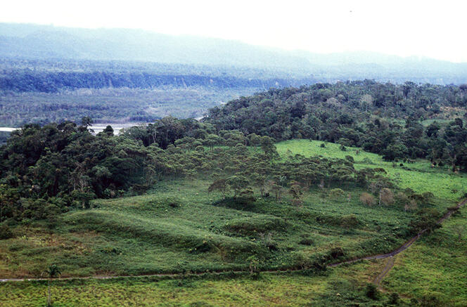
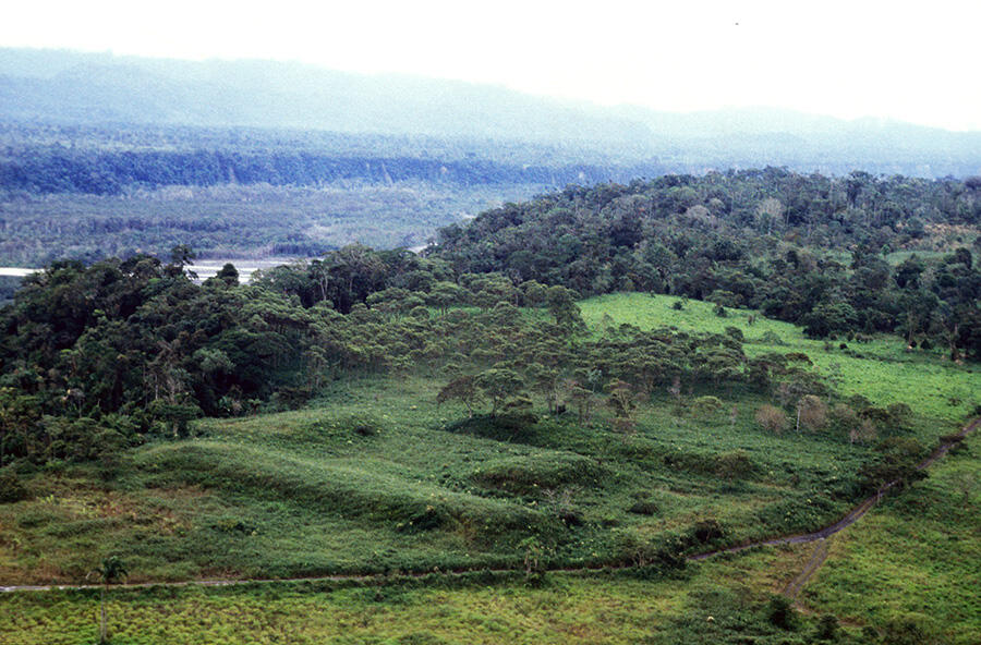
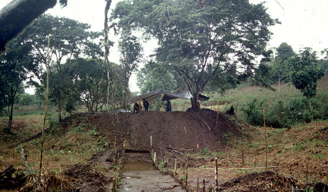
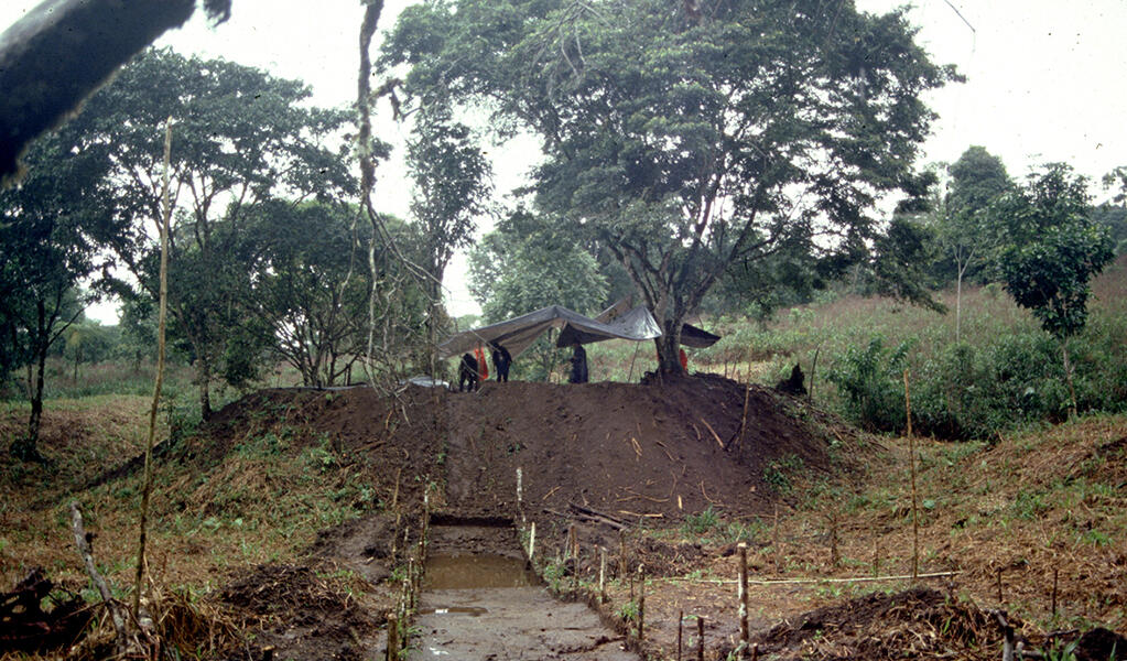
When it comes to sites as large as an entire valley, there’s no point in excavating an area the size of a telephone booth with trowels since this doesn't provide anything like enough information. So I preferred to use large-scale stripping methods, an approach that has since become increasingly popular in South America. We identified and excavated earthen platforms that were used to insulate buildings from the damp ground, as well as plazas, paths and roads. We discovered that the valley was first occupied around 500 BC and that this lasted until 400-600 AD.
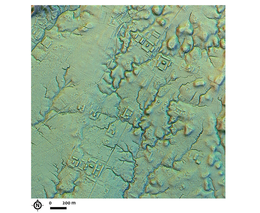
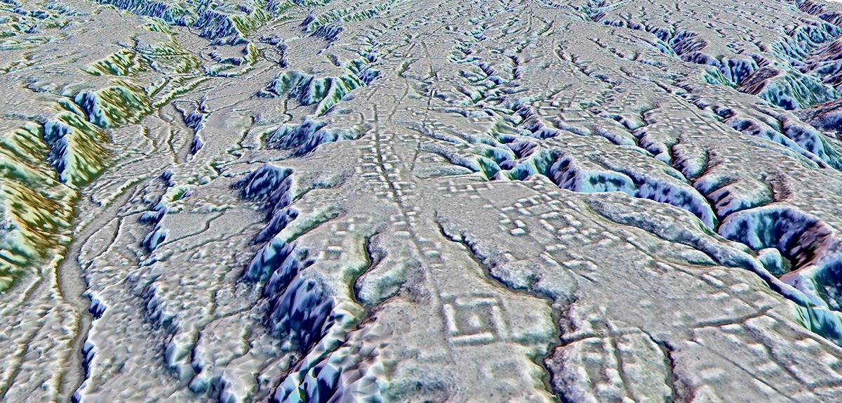
Although these various excavations at several different sites provided a lot of new material, we still had no overall view of the valley. In 2015, a private Russian company was commissioned by Ecuador's National Institute of Cultural Heritage to carry out an aerial lidar survey of the Upano Valley. This technology works rather like sonar, except that the signal used is light rather than sound. The laser beam is so fine that it travels through the canopy right down to ground level, stripping it of its plant cover. Everything is then reconstructed using computer models. This enabled us to figure out the structure of the terrain and very precisely identify any changes that had occurred.
What did you learn from these surveys, which you were able to consult in 2021?
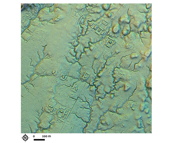
S. R.: We discovered that there weren't just hundreds of human-made platforms in the Upano Valley, but thousands. The data, which was collected over an area of 600 square kilometres, also provided us with a comprehensive map of anthropogenic changes.
The Upano Valley was home to genuine urban settlements in the middle of the tropical forest that were densely populated and laid out in a grid pattern. There was an incredibly complex network of streets, paths leading to rivers, as well as primary and secondary roads. The main ones were perfectly straight, up to thirteen metres wide, and crossed the valley with no regard for its natural relief, cutting across both ravines and higher ground. A network of this kind requires real planning, showing that the various settlements in the valley were contemporary.
The fact that ancient dwellers went to such lengths to overcome every obstacle, when it would often have been simpler just to go around them, strongly suggests that these roads had a symbolic function. They may have been a means of recording relations between neighbours, and were probably used for processions and ritualised visits, as can still be seen in the ring villages of the Upper Xingu in the Brazilian Amazon.
Some platforms were even higher, up to ten metres. Rather than serving as foundations for dwellings, it is thought that these sites were used for collective ceremonies. Similar urban systems have been discovered in Mayan settlements in Guatemala and in Teotihuacan, Mexico. The big difference is that there are no stone buildings in the Upano. In addition, there are no sites like this anywhere else in the pre-Columbian Amazon, including Brazil.
What kind of life did the people of the valley lead?
S. R.: We are still trying to estimate the population of the valley, but we do know that they must have rapidly depleted its natural resources. Analysis of the lidar data by Antoine Dorison, a postdoc at the ArchAm laboratory, led to the discovery of a grid-like system that drained off water from the waterlogged soil in order to grow crops in the gaps between the platform complexes. This technique was still being used in the 1970s by the Karibs of the Lower Orinoco in Venezuela. Agricultural terraces were also built in the foothills of the surrounding mountain ranges.
Although lidar helped us a great deal, it’s no substitute for traditional excavations. Buried in the soil in the vicinity of the dwellings, we unearthed remains and burnt seeds of various plants that had been eaten, including manioc, sweet potato, fruits, beans and, above all, maize. The latter was ground with millstones to obtain a paste which was then used to produce chicha, a thick, sweet beer that is so nourishing that it can serve as a meal. We found traces of it in huge jars, showing that the drink was consumed in large quantities. We also identified seeds from medicinal plants.
What became of the people who inhabited the valley?
S. R.: Their culture suddenly vanished around a thousand years after it had emerged, sometime around 400-600 AD as far as we know, although we can't be sure of the exact date since writing didn't exist in the region at the time. The valley was later settled by the Aénts Chicham, as the people more widely known to the public as Jivaros prefer to be called, who still live there today. In fact, the area was little visited until the mid-twentieth century, mainly because of the warlike reputation of these tribes.
I have a theory, that unfortunately has yet to be confirmed, about this disappearance. Excavations have shown, lying above the uppermost layers containing evidence of dwellings, several black layers that suggest volcanic eruptions. However, the dates don't match any event dramatic enough to cause everyone to flee. There may have been a series of smaller but more numerous eruptions, or alternatively a climate crisis, that ended up driving the inhabitants away. They might then have travelled south, to Peru, where pottery similar to that of the Upano people has been found. In any case, only a society that was specialised and stratified would have been able to build a vast, complex network like that of the Upano Valley. And as it happens, we know that urbanised, hierarchical societies are less resilient to climatic hazards. This civilisation may therefore simply have collapsed and reverted to a tribal, forest-based society. We have no firm explanation to offer at this time. But it’s still early days.
Reference
"Two thousand years of garden urbanism in the Upper Amazon", Rostain, S., Dorison, A., Saulieu (de) G. et al, Science, 11 January 2024 (vol. 383, issue 6679, pp. 183-189). DOI: 10.1126/science.adi6317
Further reading
Histoire de l'Amazonie (History of the Amazon), S. Rostain, "Que sais-je", November 2022, 128 p.
- 1. CNRS research professor at the Laboratoire Archéologie des Amériques (ArchAm – CNRS / Université Panthéon-Sorbonne), and a specialist in the archaeology of the Amazon.
Explore more
Author
A graduate from the School of Journalism in Lille, Martin Koppe has worked for a number of publications including Dossiers d’archéologie, Science et Vie Junior and La Recherche, as well the website Maxisciences.com. He also holds degrees in art history, archaeometry, and epistemology.


