You are here
A Quick Guide to Slow Earthquakes
Seismologists long believed that there were two seismic timescales: (very) long periods during which the deformation of continental plates builds up seismic energy, and very short periods when the energy stored up for hundreds or even thousands of years is released by an earthquake in a matter of seconds. It was thought that nothing happened between two quakes, or rock ruptures. "The detection of the first slow earthquakes fifteen years ago completely overturned this view," says Michel Campillo, a seismologist at the Institut des Sciences de la Terre (ISTerre).1 "We now know that transitional processes lasting from a few weeks to a few months take place without any perceptible tremors." And it is precisely because they are so imperceptible that they had gone completely unnoticed until then.
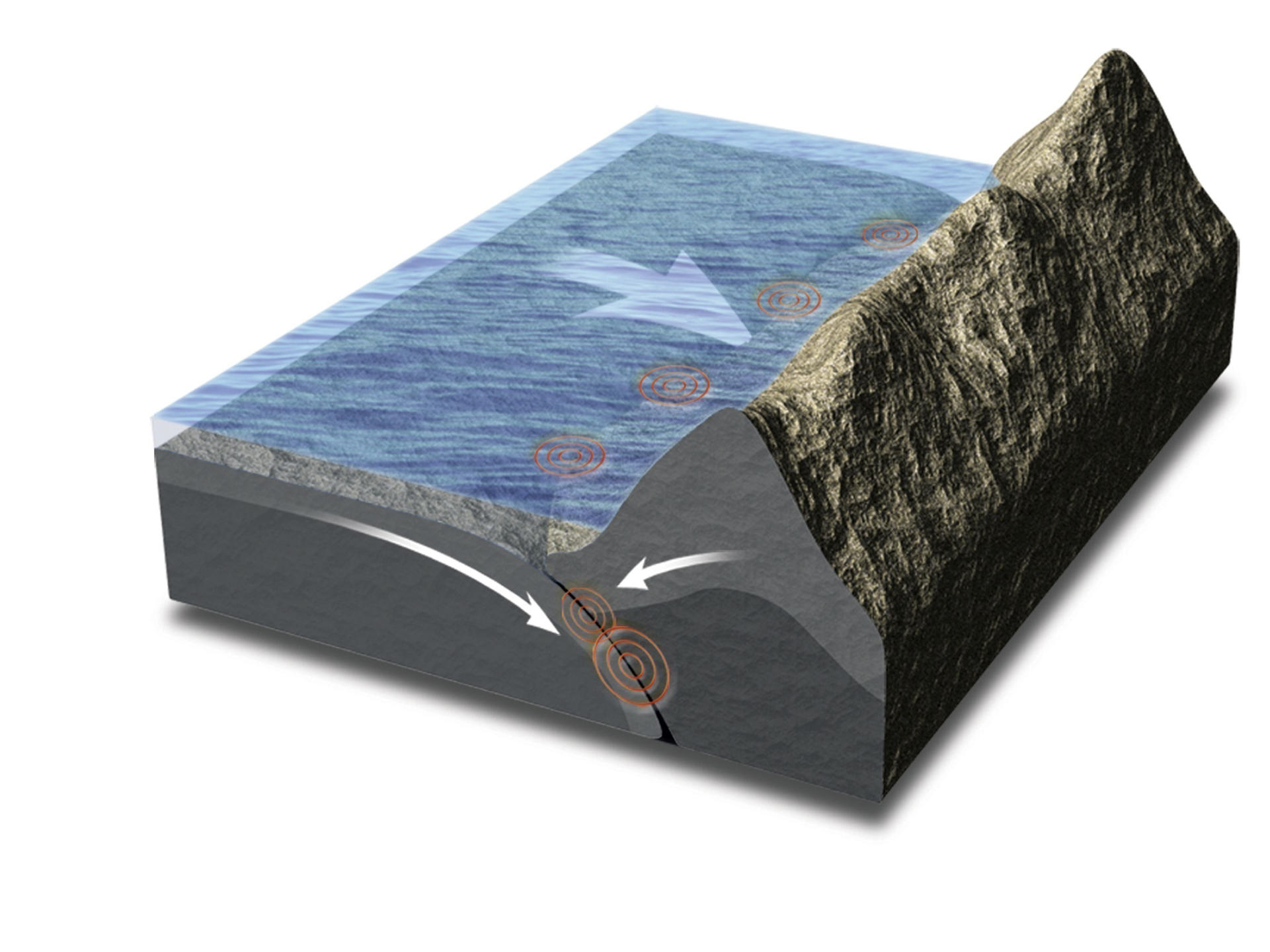
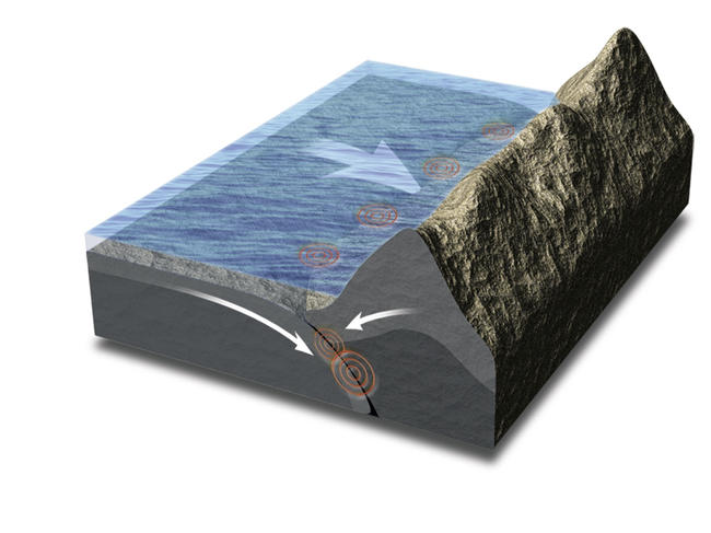
Eighty per cent of the most powerful earthquakes on the planet, with a magnitude exceeding 6, take place at subduction zones, at the boundary where oceanic platesFermerThe ocean floor constantly renews itself at the mid-ocean ridges; denser than the continental plates that border them, oceanic plates slide beneath them before sinking into the Earth's mantle. descend beneath neighboring continental plates. Two scenarios are then possible: the descending oceanic plate either slides without any apparent difficulty beneath the continental plate, or it "gets stuck" and exerts pressure on the plate, causing it to deform slowly and build up energy which, just like a stretched spring that suddenly snaps back into place, is released during the next earthquake. It is in these subduction zones, where earthquakes often occur, that all slow earthquakes have been detected so far.
Continuous GPS measurements
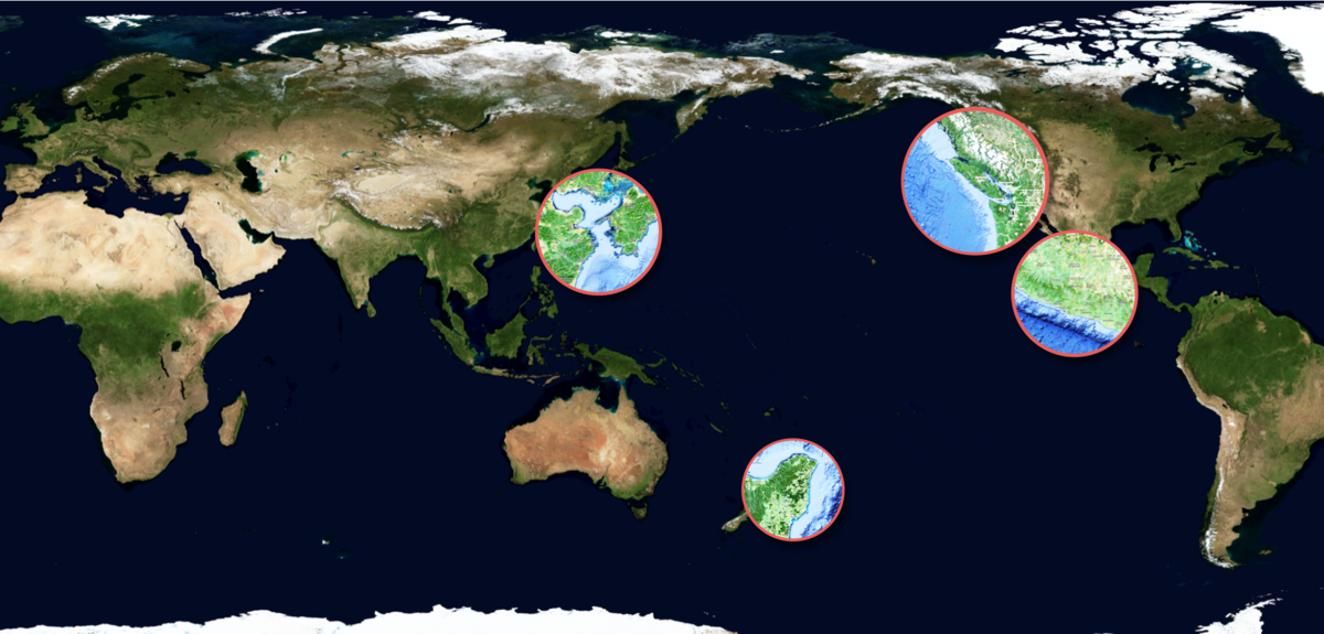
"The first slow earthquakes were detected in 2001 in the Cascade Mountains near Vancouver, in Canada," says Nikolaï Shapiro, a seismologist at the Paris Institute of Earth Physics.2 "They were then observed in Japan, New Zealand, Costa Rica and Mexico, not far from Acapulco." Their almost perfect regularity continues to baffle the specialists. "In the Cascades, slow earthquakes last two weeks and are repeated every fourteen months on average; in Mexico, where the oceanic plate is rapidly converging with the continental plate at a rate of around 6 centimeters per year, they go on for six months and occur every four years," Shapiro explains.
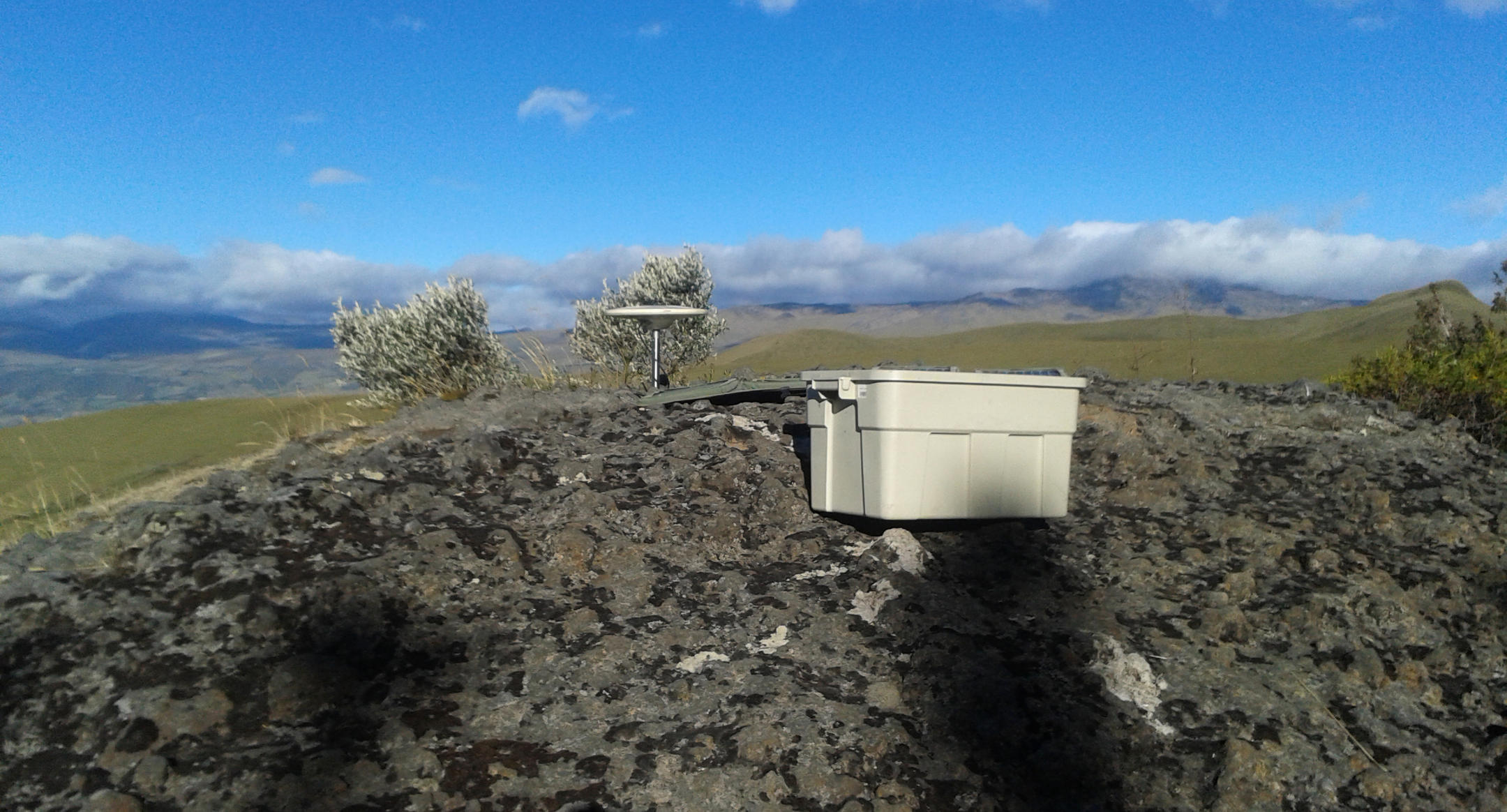
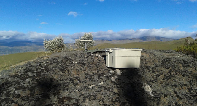
Progress in GPS measurements made it possible to identify slow earthquakes. "Recorded positions have become so accurate, down to the nearest few millimeters, that they can now be used to carry out continuous recordings," explains Frédérique Rolandone, a geophysicist specialized in geodesyFermerThe science that measures and represents the Earth's surface, calculates the distances between different points on the surface and movements of the Earth's crust. at the Paris Institute of Earth Physics, who spent a year working in the field in Ecuador. As a result, networks of GPS stations have been deployed to record plate motion near subduction zones and estimate plate deformation. " Japan, currently the best equipped country, has around a thousand stations, spread out every 10 to 20 kilometers or so," the researcher says.
This GPS "profiling" is based on the principle that, provided all the stations on the surface of the continental plate move at the same speed and in the same direction as the oceanic plate that is descending into the mantle, there is no deformation. On the other hand, if the recorded speeds vary from one station to another, deformation occurs, exerting increased pressure on the continental plate. "What's interesting is that the direction in which the stations move is reversed during the few seconds' duration of an earthquake—rather like a stretched elastic band that is released and snaps the other way," Shapiro says. "It's when the GPS records revealed changes of direction lasting several weeks that we suspected we had come across a new phenomenon, now known as slow earthquakes."
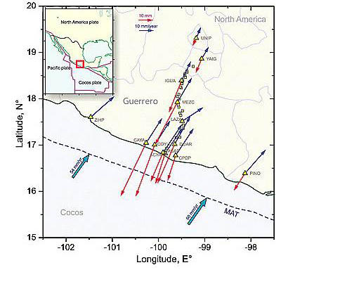

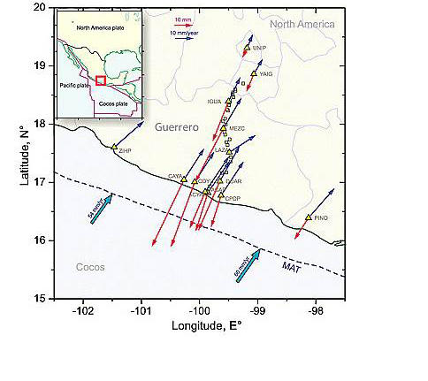
Although they are slow and totally harmless to the populations who live nearby, these quakes are by no means insignificant. The amount of energy they release is on a par with large seisms: the most powerful recorded to date occurred in Mexico and were equivalent to earthquakes with a magnitude of 7.5 on the Richter scale, exceeding the latest Haiti quake (7.3) which left 200,000 dead and huge amounts of damage.
Uncertain effects on 'real' earthquakes
Scientists nonetheless remain divided about the effects of these processes on the seismic risk in affected regions. Do slow earthquakes act like a pressure cooker's safety valve, warding off the onset of a devastating 'real' earthquake by releasing some of the pressure? Or, on the contrary, do they increase the risk of a quake by amplifying the deformations in nearby fault segments? "In Guerrero, near Acapulco, slow earthquakes occur in a seismic gap, an area where no quakes have been recorded for over a century, even though the entire subduction zone that runs alongside Mexico is regularly shaken," Shapiro points out. "Yet at this stage, no one can tell whether this lack of activity is due to slow earthquakes, or whether the next seism is only a matter of time!"
"Once we've understood all the implications of these slow slips, we'll be able to produce far more accurate energy budgets for each fault segment, and hence better assess seismic risk in the medium-term," Rolandone believes. "However, a lot of observational work remains to be done before we get to that point." The number of slow earthquakes recorded to date is insufficient to draw any definitive conclusions. To remedy this, networks of sensors would have to be deployed next to every subduction fault, which is far from being the case today. "In Ecuador, around 50 recently installed GPS stations enabled us to observe the first slow earthquakes in 2010," the researcher points out.
Another challenge for scientists is to take GPS measurements in marine environments by installing GPS stations on the seabed. Some subduction zones are situated a long way from land areas affected by earthquakes, which makes it more difficult to estimate deformations: this is the case not only in Japan, but also in the Caribbean, where the fault is located more than 200 kilometers from the coast. "In theory, the electromagnetic signal broadcast from satellites to GPS stations cannot travel through water," Campillo explains. "However, this obstacle is now overcome by coupling acoustic transmitters placed on the seabed with GPS-equipped ships at the surface. Admittedly, readings are not taken continuously, as with ground-based GPS stations, but they should enable us to significantly refine our understanding of these slow processes." Already installed off the coast of Japan, these facilities will also be deployed as of this summer along the Mexican shore—where they might solve the puzzle of the Guerrero seismic gap.


